From our friends at https://www.gofingerlakes.org
Top Six Paddling Locations in the Finger Lakes Region
On a warm spring afternoon, there is no better way to enjoy the beauty of the Finger Lakes than by boat. While many people are familiar with boating on the open waters of the lakes themselves, exploring the region in a kayak, paddleboard or canoe can be incredibly rewarding.
From two wild lakes to bayou-like swamps to a mighty river, the region boasts a diversity of opportunities for quiet water paddling. Recent interest has brought new outfitters to the region, adding ease to coordinating a spontaneous outing. Make planning even easier by visiting gofingerlakes.org – a new web site created by the non-profit Finger Lakes Land Trust to help connect people to the region’s best outdoor adventures.
Here are six of our favorite spots to enjoy by boat.

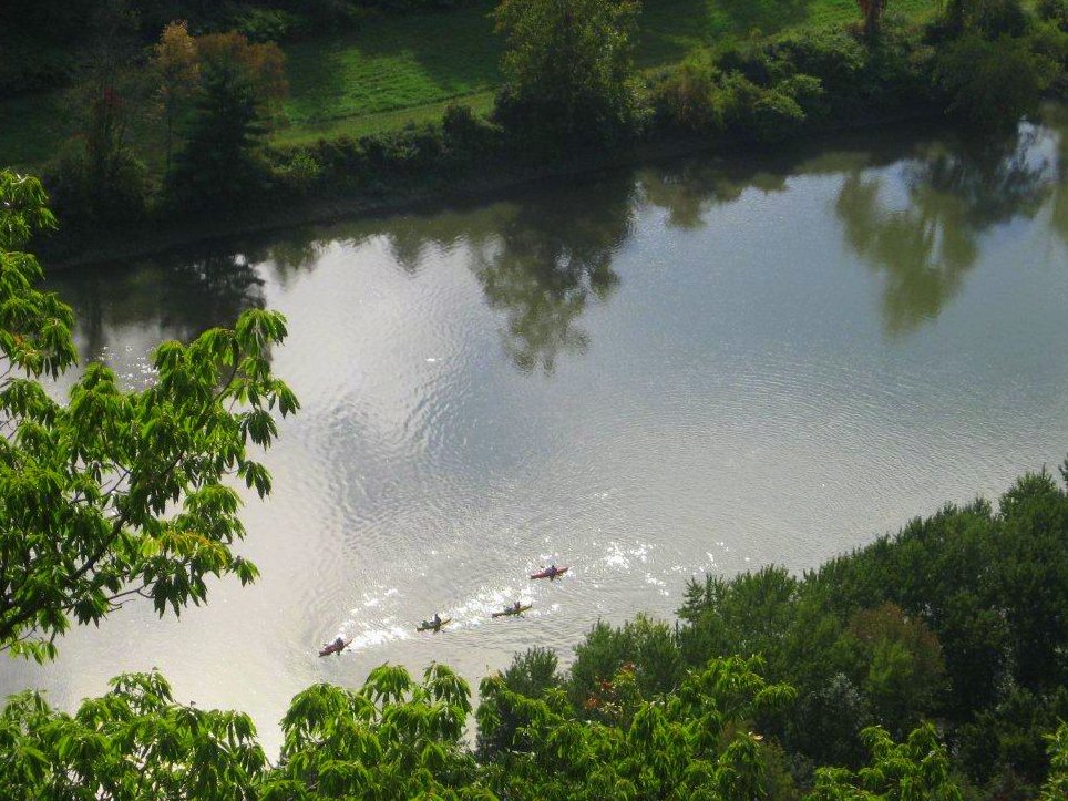
Paddling the Chemung River. Photo: Jim Pfiffer Chemung River
Wild rivers in New York are typically thought to be found only in the Adirondack Park, but the Chemung River is a great alternative for paddlers looking for a scenic trip local to the Finger Lakes region. The river is over 45 miles long, but many first-time visitors will prefer the six mile stretch between Bottcher’s Landing in Big Flats and the Fitch’s Bridge pullout just west of Elmira. This stretch of the river is particularly picturesque and passes under the steep Palisades, a long sinuous cliff hundreds of feet high that looms over the river along its southern shore.
Paddling the six mile stretch should take a couple hours but trips of a few days are also possible. It is even possible to continue along the Chemung to the Susquehanna and eventually to the Chesapeake Bay on a river adventure of epic proportions. Connect with one of many outfitters in the area to make your river trip easy.

Canadice Lake. Photo: Nigel Kent Hemlock-Canadice State Forest
Paddlers are welcome to enjoy over 2,000 acres of tranquil water, free of the common boat traffic found on all of the other Finger Lakes. The shores of these gems are free of development and utterly wild, so exploring Hemlock-Canadice State Forest is like stepping back in time to behold the Finger Lakes in their natural state.
Please note: there is no swimming here. Otherwise, these preserved lands offer an abundance of recreational activities. With placid water to paddle and over 20 miles of multiuse trails surrounding the lakes, there is a lot to do and see and the opportunities are expanding.

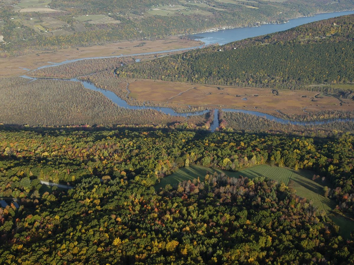
West River and Hi Tor Wildlife Management Area. Photo: Chuck Feil West River
Over four miles long, the meandering West River, as well as trips along tributaries, provides ample paddling in an almost idyllic landscape. Tall cattails and thick lily pads carpet the banks throughout the 1,700-acre marshland. Surrounded by forested hillsides, the river and vast wetlands are truly peaceful and a world unto itself. In fact, paddling up the West River to the developed shores and loud motors on Canandaigua Lake feels a bit like stepping forward in time as the wilderness cedes to civilization. It is akin to Adirondack paddling trips and a true testament to how removed the river and wetlands actually feel.
Ambitious paddlers can explore the lake itself, but be advised strong north-south winds sometimes fill the center of the lake with tall waves. Various car top launch points are available along the river as well as on the southwest corner of Canandaigua Lake.

Howland Island Wildlife Management Area. Photo: Bill Hecht Howland Island
Paddlers will enjoy both the river and canal surrounding Howland Island with the added benefit that this is a “round” river trip. This type of configuration means you can paddle the river and canal and end up right where you started without retracing your course. As expected, these experiences are very rare and make planning a trip easy. The entire circuit would be about 10 miles and this includes the Seneca River, the Swift Water Channel, and the Erie Canal.
Longer trips can be created by navigating further along the Seneca River and looping back along the Erie Canal further to the southwest. While larger powered boats will be encountered along the canal these large boats tend to avoid the river due to thick weeds and other obstructions. The Montezuma Audubon Center, the informational hub for the Wetland Complex, offers regular, naturalist-guided, paddling trips to further enhance the experience.
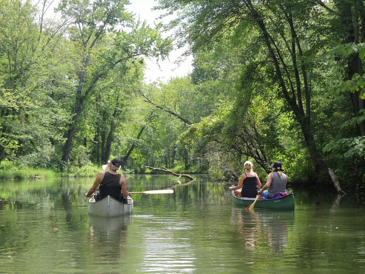
Owasco Inlet. Photo: Bill Hecht Owasco Flats
At the southern end of Owasco Lake are an inlet and diverse floodplain that provide excellent birding, paddling, and a couple of short nature trails. Commonly known as Owasco Flats, the inlet serves as an important habitat for fish spawning within its emergent marshes, which also does double duty as a natural water quality buffer for Owasco Lake.
During the spring, runs of rainbow trout will find fishermen nearly shoulder to shoulder along the inlet trail. But paddling along the inlet is the activity that really shines here. The slow and quiet paddler will be rewarded with ample bird spotting and rare photo opportunities. When conditions permit, paddlers can explore the inlet all the way to Rt. 38 in Moravia.
Staghorn Cliffs on Skaneateles Lake. Photo: John Sutton Staghorn Cliffs
A paddle along Skaneateles Lake’s eastern shore will wow paddlers young and old. Leave from the boat launch at the Town of Scott Family Park, located just off of Glen Haven Road. From there, a two-mile paddle along the lake’s edge will bring you to the Finger Lakes Land Trust’s Cora Kampfe Dickinson Conservation Area which protects 1,300 feet along the bluffs known locally as the “Staghorn Cliffs.”
Here, the lakeshore bedrock contains staghorn coral fossils. Peer into the water or step out of your boat to see an ancient coral reef from the Devonian Period, ca. 400-350 million years ago.